NGORONGORO CRATER
Ngorongora Crater is the largest unbroken volcanic caldera, a collapsed volcano, in the world. Calderas are classified as extreme volcanos. They are extremely powerful and catastrophic. Formed by geological faulting, it is 259 square kilometers with walls over 600 meters high. As a volcano, it was estimated to be larger than Mount Kilimanjaro. The withdrawal of lava caused it to collapse, creating the crater that exist today. The video below illustrates how a caldera is formed.
Picture 1


 In pictures two and three, we can see the effects of basalitc lava flow. When a volcano erupts, pressurized magma forces its way out of the mountain at its highest peak, allowing the magma to seep through other cracks on the earth's mantal. When fluid basalt flows, it can be extremely violent traveling tens of kilometers away from an erupting vent. When the lava flows over the land, it cools creating a smooth landscape. Basalt is the hard black rock formed from the basaltic lava. Evidence of the lava flow can be seen in the landscape by the smooth texture seen on the mountain. Minerals from the Earth, as well as ashes from the eruption, fertilizes the land. Over time this violent, destructive event produces land that is abundant with a variety of plant life and creates an environment prosperous with wild-life.
In the picture below we can see evidence of the formation of rills and gullies. Rills are created from small channels of water traveling down the slopes of the volcano. Gullies are formed by larger bodies of water eroding the mountainside as it travels down the slopes. Gullies can form independent sources of water or form from a collection of rills. This beautiful landscape is the result of water eroding the slopes of the volcano.
Ngorongoro Crater

Ngorongora Crater is the largest unbroken volcanic caldera, a collapsed volcano, in the world. Calderas are classified as extreme volcanos. They are extremely powerful and catastrophic. Formed by geological faulting, it is 259 square kilometers with walls over 600 meters high. As a volcano, it was estimated to be larger than Mount Kilimanjaro. The withdrawal of lava caused it to collapse, creating the crater that exist today. The video below illustrates how a caldera is formed.
Demonstration Video: How Exactly is a Caldera formed?
Picture 1
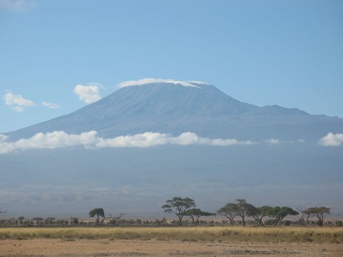
Tanzania is the home of one of the world's greatest attractions, a large cinder cone volcano and a large dormant volcano crater known as Ngorongoro. This large cinder cone volcano was formed roughly two to three million years ago. Violent eruptions shot large amounts of lava and ash into the air, allowing lava to flow down the side of the volcano, and it creating smooth cliffs on the side of the crater. After numerous eruptions the volcano grew in size creating a mountain uplift and evidence of lava flow that created this mountain as seen in picture one.
Picture 2
Picture 3

Ngorongoro Crater


